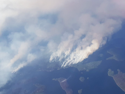
In this ‘year of fire’ a joint UK and Canadian team are currently flying imaging surveys above the boreal wildfires of Northern Ontario, to learn more about their behaviour and to evaluate the performance of algorithms being designed to monitor fires from the infrared data collected by Earth orbiting satellites. The campaign is being led by Professor Martin Wooster of King’s College London and NERC’s National Centre for Earth Observation (NCEO), who travelled to Canada with researcher Dr Kari Hyll who has worked extensively on the methods used to analyse the IR data. Dr Weidong Xu, who is working on the Sentinel-3 data analysis, is supporting the team from London to provide regular updates of what the satellite can see.
Wildfires burn an area around 20 times that of the UK every year on average, with this year being particularly severe in Greece, Portugal and California. Amongst its many roles, the new European Sentinel-3 satellite carries the Sea and Land Surface Temperature Radiometer (SLSTR), which has been designed to observe the Earth at specific infrared wavelengths in order to detect fires and measure their thermal radiant energy emissions. Such data can provide near-continuous information related to how much vegetation and organic soil is being consumed by the fires, and how much smoke is being emitted into the atmosphere. This type of information is extremely useful for supporting air quality modelling and forecasting, for assessing the contribution global fires make to rising atmospheric greenhouse gas concentrations, and potentially also for supporting fire response operations.

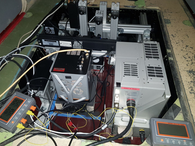
With financial support from the Natural Environment Research Council (NERC), NERC’s National Centre for Earth Observation (UK) and the European Space Agency (ESA), the UK team have worked with the NERC Airborne Research Facility (ARF) operated by British Antarctic Survey (BAS), fitting a host of new infrared (IR) imagers to a BAS Twin Otter survey aircraft to provide a new IR imaging capability. The aircraft is now packed with highly sensitive imaging equipment, capable of detecting even the smallest parts of wildfires from its flying altitude of 8500 ft. This highly capable airborne science laboratory is being flown over the fires at the time of the Sentinel-3 satellite overpass, in order to be able to compare the information extracted from the airborne and satellite infrared imagery.

Running the instruments onboard, in the dark and whilst flying above active wildfires is a complex, exciting task, and it takes a lot of perseverance (and luck) to be able to capture the required imagery at the correct time without cloud cover interrupting the satellites view of the fire. Fortunately, so far everything is working well, and three science flights have been achieved with excellent results above the same fire burning across the forests of Northern Ontario.
The campaign is being run in collaboration with partners from the Canadian Forest Service (Natural Resources Canada) and the Ontario Ministry of Natural Resources & Forestry, Aviation Forest Fire & Emergency Services, who have provided essential expertise and logistics in country.