British newspaper cartoons from 1914
Selected by Kate O’Brien, Archives Services Manager
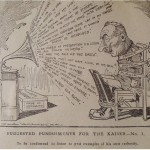
What
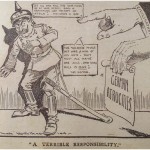
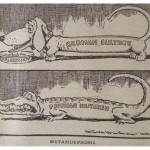
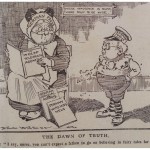
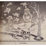
British newspaper cartoons ridiculing Kaiser Wilhelm II and German militarism. They are within seven volumes of thousands of press cuttings amassed and carefully dated, August – November 1914. Unfortunately the original newspapers are not identified.
Why
My great grandparents were among those Germans living in Britain who changed their name (‘Kraus’ to ‘Crisp’) at the outbreak of war. So I was interested to see that these cartoons from 1914 do not focus on demonising the German nation as a whole, or the large German population already living here. Instead they concentrate on the Kaiser as a risible, vain-glorious figure, and some even present the German civilian population in a sympathetic light.
Ref: Liddell Hart 15/2/18/3-4
www.kingscollections.org/catalogues/lhcma/collection/l/li30-001