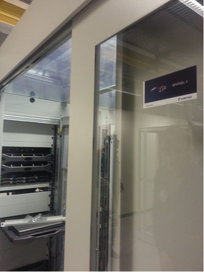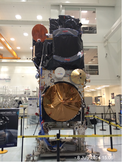
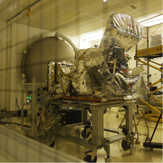
Professor Martin Wooster has been involved with the preparations for the forthcoming launch of the European Space Agencies first Sentinel-3 satellite, currently scheduled to take place from the Plesetsk Cosmodrome in Russia on 10th October 2015 via a Rokot launch vehicle, a redesigned Intercontinental Ballistic Missile and a true example of ‘swords into plough shears’ technology. The primary mission of the 1.25 tonne Sentinel-3 satellite is to provide highly accurate, regular and operationally available information about the state of Earth’s land and oceans, and also to some extent Earth’s atmosphere.
One of the Earth Observation (EO) instruments carried by Sentinel-3 is the Sea and Land Surface Temperature Radiometer (SLSTR), a remote sensing instrument capable of providing near-daily calibrated measurements of the light emitted and reflected by the Earth in 11 different spectral channels covering visible to thermal infrared wavelengths (0.55 – 12.0 µm) at a spatial resolution of between 0.5 and 1 km. These data will be processed via computer-based algorithms into, for example, routinely updated maps of global sea surface temperature (SST), atmospheric aerosol distribution, and land temperature and vegetation, in order to support climate monitoring, numerical weather forecasting, vegetation monitoring and hazard early warning to name just a few examples.
The specific involvement of King’s lies with SLSTR’s ability to measure and monitor global vegetation fires from space, an approach in which the research group of Professor Wooster in the Department of Geography has an international reputation. Living in the UK the prevalence of such ‘open biomass burning’ is not obviously apparent, but every year Earth’s landscape-scale fires convert very significant amounts of carbon stored on the land (as vegetation and organic soils) and place it directly into the atmosphere as the greenhouse gas CO2, alongside many other smoke constituents in lesser amounts but which are also be climatically and/or chemically very important. Landscape-scale fires are, for example, amongst the most significant global sources of carbon monoxide gas and black carbon particles to the atmosphere, both of which have roles in the radiative forcing of climate and as air pollutants. Indeed, since much of the CO2 released by fires gets re-absorbed by plants during subsequent periods of re-growth, it could be argued that these types of non-CO2 gases and particles released by global vegetation and organic soil burning are actually the more significant impact.
SLSTR will provide the capability to keep track of this global fire activity, including on a worldwide daily basis once two Sentinel-3 satellites are operating concurrently from 2017 onwards. SLSTR does this via the detection and measurement of the thermal radiation the fires emit whilst they are burning, and the instrument is an evolution of the original Along Track Scanning Radiometer (ATSR) launched onboard Europe’s ERS satellite in 1991 for the measurement of sea surface temperature (SST) and whose data Wooster first used in 1994 during his PhD on the study of thermal activity at Earth’s volcanoes. The quality of the data provided by ATSR and its successors ATSR-2 and AATSR, and their use in a wide range of applications beyond their initial SST remit has ultimately led to the design of the significantly more capable SLSTR, which will provide data not only for operational SST measurements but also a wide range of other applications only partly able to be supported by the prior (A)ATSR sensors. With regard to landscape-scale fires, SLSTR will be able to map the changing distribution of biomass burning activity over seasons and across the years, providing estimates of the rate at which vegetation and soils are being consumed and material is being injected into Earth’s atmosphere, and with the possibility to detect shifts in this activity in response to climate and/or environmental changes, be it extending wildfire seasons in the boreal forests, alterations in agricultural residue burning patterns in Asia as a result of socio-economic developments, changing rates of forest and peatland burning in the tropics related to deforestation practices, monitoring the regular large-scale combustion seen across savannahs on many continents, or keeping tabs on the extreme fire episodes that occur occasionally in southern Europe and which can greatly affect regional air quality.
Wooster has been involved with advising on the specifications of two dedicated ‘fire measurement’ channels on SLSTR that are optimised to provide regularly updated maps of Earth’s landscape scale fires, and to quantify their radiative energy release rate such that estimates of the amount of material they are placing into Earth’s atmosphere can be obtained. This information will be flow into what are now termed the ‘Copernicus Services’, a series of computer-based monitoring, modelling and forecasting systems aimed at aiding the management and protection of Earth’s environment and natural resources, and to ensure civil security. The Copernicus Atmosphere Service in particular will provide global monitoring and forecasting of the entire Earth’s atmosphere on a daily basis, combining information from models and observations, and providing a daily 5-day forecast, for example in support of air pollution earthly warning. Members of Professor Wooster’s research group at King’s (Dr Ronan Paugam and Dr Weidong Xu) have been involved in the Copernicus Atmosphere Service delivery with regard to landscape fire emissions, and Xu has worked with Wooster to deliver the algorithm that is going to turn the ‘raw’ SLSTR observations into useful information on global fire activity. Wooster is the ‘fire specialist’ for the Sentinel-3 mission’s expert support laboratory, and is part of the Mission Validation Team. He will work with Xu during the post-launch 5-month commissioning phase to optimise and validate the SLSTR algorithms performance in order to ensure that the landscape fire information provided to the Copernicus Atmosphere Service and to other users worldwide is as accurate and precise as possible. After this five month period it is expected that the SLSTR will start to provide routine, regular and easily accessible data on global fire activity for both the Copernicus Service and other users worldwide.